|
Development of the Three Condit Communities |
||||
|
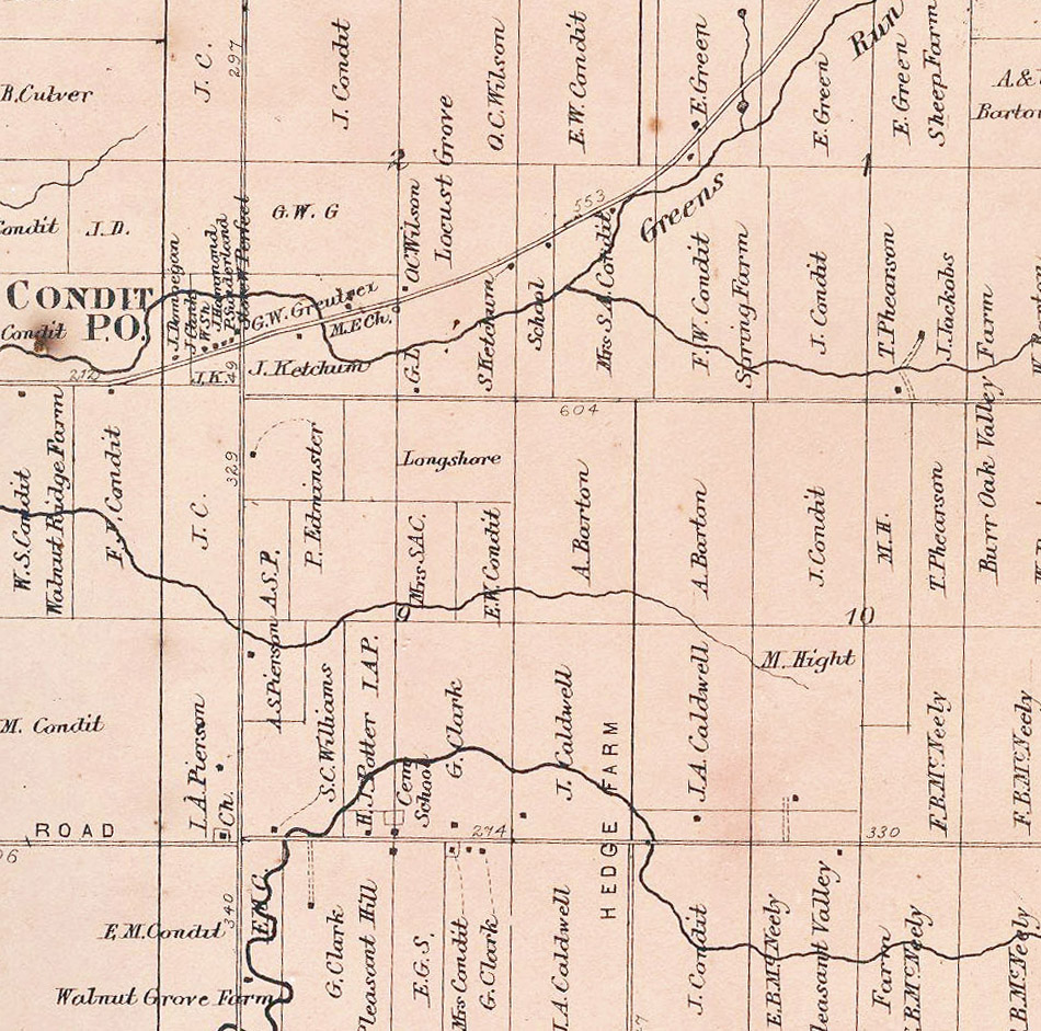
Map from 1866 Beers Atlas Trenton Township
Three Condits sprang up along the 605 roadway. The CCC highway
intersected to form Condit which had the post office
Old CCC Highway through ►
Hartford or Croton Road and 605 became a second community centered around the Presbyterian Church which was built on the north west side of the intersection. South Condit Hartford Road ► |
 |
|||
| 605▼ | ||||
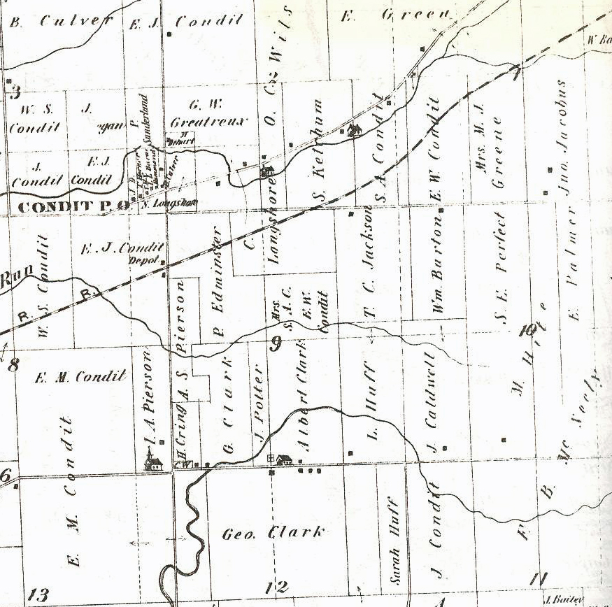 |
◄Railroad made Condit Station | |||
| The railroad
chose to cross 605 at yet a third point and this intersection became
known as Condit Station. In addition to the depot, there was a
mill which became the Landmark Co-op. When CCC was improved in
the late 1940s it was straightened and paralleled the railroad.
Eventually a gasoline station was added to the area.
Illustrated Historical Atlas of Delaware County
Ohio |
||||
| 605▼ | ||||
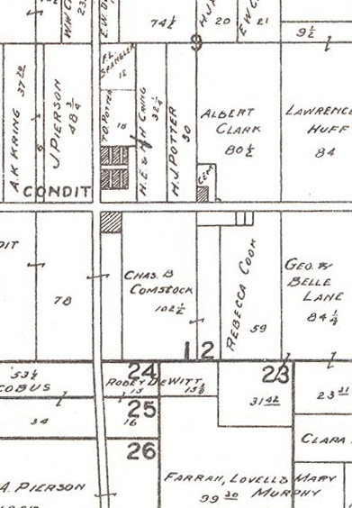
| Modie's
Centennial Atlas of Delaware County, Ohio 1908
South Condit Hartford Road ► |
 |
|||
| Return to
Condit Town Return to Local History Index |
(03/30/2011) |
|||